- Home
- Tutorial
- Resource Guides
- Focus Areas
- LSF Programs
-
Professional
Development - Review Process
-
A project of LSF

Search for Resources
Description
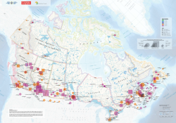
This resource uses the FloodSmart Canada tiled map to help students investigate where and when floods have occurred across Canada since 1900. By assembling and interpreting the map, students will identify geographic patterns in flood occurrences and explore the natural causes of flooding and its impacts on communities. They will research selected Canadian flood events using reliable databases and scientific sources, while considering why certain regions are more vulnerable to flooding and how climate change may influence the frequency and severity of floods.
Students will:
- discuss floods in Canada as they assemble the FloodSmart Canada tiled map
- identify floods that have happened in Canada since 1900
- use the geo-inquiry process to answer research questions related to flooding in Canada
- research floods in Canada using national databases and scientific sources.
- share their research results with the class in the form of a group presentation
- consider the connection between climate change and flood frequency and intensity
Link to download the Floods in Canada Tiled Map
General Assessment
Strengths
- Particularly relevant as flooding becomes more frequent and severe across Canada.
- Integrates authentic Canadian data
- Students are encouraged to connect climate change to flooding and the frequency and intensity of flooding
- Multiple ways to communicate learning, charts, maps, graphs, word clouds, photo essays, video
- Offers suggestions to extend the learning beyond the main activities
- The lesson and map are available in English and French
Weaknesses
- No rubrics or detailed assessment criteria are provided
- No suggestions to act on learning, more focused on research, analyzing and communicating information
- The resource does not include experiential learning opportunities that take place outdoors.
- Requires teacher preparation to print and assemble the large titled map
- The resource could provide more differentiated strategies and supports for students who require additional assistance.
Relevant Curriculum Units
The following tool will allow you to explore the relevant curriculum matches for this resource. To start, select a province listed below.
- Step 1Select a province
- Alberta
- Step 2Select a grade level
- Grade 9
- Step 3Select a subject
- Environmental Science
- Step 4Relevant matches
- Environment and Outdoor Education: Environmental Investigations
- British Columbia
- Step 2Select a grade level
- Grade 11
- Step 3Select a subject
- Science
- Step 4Relevant matches
- Earth Science 11:The distribution of water has a major influence on weather and climate.
- Science for Citizenship 11: Scientific understanding enables humans to respond and adapt to changes locally and globally
- Grade 12
- Step 3Select a subject
- Science
- Step 4Relevant matches
- Specialized Science 12: Climate change impacts biodiversity and ecosystem health
- Manitoba
- Newfoundland & Labrador
- Northwest Territories
- Step 2Select a grade level
- Grade 11
- Step 3Select a subject
- Science
- Step 4Relevant matches
- Earth Science 11:The distribution of water has a major influence on weather and climate.
- Science for Citizenship 11: Scientific understanding enables humans to respond and adapt to changes locally and globally
- Grade 12
- Step 3Select a subject
- Science
- Step 4Relevant matches
- Specialized Science 12: Climate change impacts biodiversity and ecosystem health
- Nova Scotia
- Nunavut
- Ontario
- Step 2Select a grade level
- Grade 9
- Step 3Select a subject
- Geography
- Step 4Relevant matches
- Exploring Canadian Geography: Geographic Inquiry and Skill Development
- Exploring Canadian Geography: Liveable Communities
- Grade 10
- Step 3Select a subject
- Science
- Step 4Relevant matches
- Science (Academic):Earth and Space Science: Climate Change
- Science (Applied)::Earth and Space Science: Earth's Dynamic Climate
- Prince Edward Island
- Step 2Select a grade level
- Grade 12
- Step 3Select a subject
- Environmental Science
- Step 4Relevant matches
- Environmental Science 621A: Environmental Challenges and Successes
- Geography
- Step 4Relevant matches
- Geography 621A Global Issues: Introduction- What is a global issue?
- Saskatchewan
- Yukon Territory
- Step 2Select a grade level
- Grade 11
- Step 3Select a subject
- Science
- Step 4Relevant matches
- Earth Science 11:The distribution of water has a major influence on weather and climate.
- Science for Citizenship 11: Scientific understanding enables humans to respond and adapt to changes locally and globally
- Grade 12
- Step 3Select a subject
- Science
- Step 4Relevant matches
- Specialized Science 12: Climate change impacts biodiversity and ecosystem health
Themes Addressed
Air, Atmosphere & Climate (2)
- Climate Change
- Weather
Sustainability Education Principles
| Principle | Rating | Explanation |
|---|---|---|
| Consideration of Alternative Perspectives | Very Good | The resource considers multiple perspectives by exploring flooding in different regions of Canada and examining its impacts on various communities. The lesson plan also provides students with links to a variety of national databases and scientific sources to support their research on flood events in Canada. |
Consideration of Alternative Perspectives:
| ||
| Multiple Dimensions of Problems & Solutions | Good | The lesson plan addresses the environmental and social dimensions of flooding. Students explore the natural causes of flooding, geographic patterns, and the potential connection between climate change and flood frequency and intensity. The lesson examines the impacts of floods on communities and encourages students to investigate specific flood events. |
| Multiple Dimensions of Problems & Solutions: Effectively addresses the environmental, economic and social dimensions of the issue(s) being explored.
| ||
| Respects Complexity | Good | The resource recognizes the complexity of flooding by examining its natural causes, geographic patterns, impacts on communities, and potential connection to climate change. |
| Respects Complexity: The complexity of the problems/issues being discussed is respected. | ||
| Acting on Learning | Satisfactory | The lesson focuses primarily on understanding and researching flooding rather than taking action to create positive change. |
| Acting on Learning: Learning moves from understanding issues to working towards positive change — in personal lifestyle, in school, in the community, or for the planet
| ||
| Values Education | Satisfactory | Students divide communication and presentation responsibilities among the members of their group, and use a presentation method of their choice to describe their research and tell an informative story about the causes, effects and implications of flooding in their region. |
| Values Education: Students are explicitly provided with opportunities to identify, clarify and express their own beliefs/values. | ||
| Empathy & Respect for Humans | Poor/Not considered | Not considered in this resource. |
| Empathy & Respect for Humans: Empathy and respect are fostered for diverse groups of humans (including different genders, ethnic groups, sexual preferences, etc.). | ||
| Personal Affinity with Earth | Satisfactory | The resource helps students understand natural processes that cause flooding and how flooding affects different regions and communities. This can develop an appreciation for the natural environment and the forces that shape it. |
| Personal Affinity with Earth: Encourages a personal affinity with -the natural world.
| ||
| Locally-Focused Learning | Good | Students use the FloodSmart Canada map to visualize and interpret flood occurrences and patterns in Canada. Students will learn about the natural causes of floods and their implications for communities commonly affected by flooding. |
| Locally-Focused Learning: Includes learning experiences that take advantage of issues/elements within the local community.
| ||
| Past, Present & Future | Good | Students will identify floods that have happened in Canada since 1900 and research specific areas prone to flooding in the future. |
| Past, Present & Future: Promotes an understanding of the past, a sense of the present, and a positive vision for the future. | ||
Pedagogical Approaches
| Principle | Rating | Explanation |
|---|---|---|
| Open-Ended Instruction | Good | The lesson plan provides some open-ended learning opportunities as students interpret flood patterns and conduct research using different sources. |
| Open-Ended Instruction
: Lessons are structured so that multiple/complex answers are possible; students are not steered toward one 'right' answer. | ||
| Integrated Learning | Good |
|
| Integrated Learning: Learning brings together content and skills from more than one subject area
| ||
| Inquiry Learning | Satisfactory | The inquiry is relatively structured, with objectives, materials and activities guiding students through the investigation. |
| Inquiry Learning: Learning is directed by questions, problems, or challenges that students work to address.
| ||
| Differentiated Instruction | Good | The lesson plan provides modifications for the infographic activity but does not provide specific modifications or accommodations for students with learning difficulties. |
| Differentiated Instruction: Activities address a range of student learning styles, abilities and readiness.
| ||
| Experiential Learning | Good | The resource incorporates some elements of experiential learning by connecting students to the real-world issue of flooding using the Flood Smart map to visualize and interpret flood occurrence and patterns in Canada. |
| Experiential Learning: Authentic learning experiences are provided
| ||
| Cooperative Learning | Good | Students work together to analyze the FloodSmart map, discuss patterns of flooding in Canada, and share their research findings. |
| Cooperative Learning: Group and cooperative learning strategies are a priority.
| ||
| Assessment & Evaluation | Good | The lesson plan provides a few assessment suggestions, but no rubrics are provided. |
| Assessment & Evaluation: Tools are provided that help students and teachers to capture formative and summative information about students' learning and performance. These tools may include reflection questions, checklists, rubrics, etc. | ||
| Peer Teaching | Good | Students will share their research results with the class in the form of a group presentation. |
| Peer Teaching: Provides opportunities for students to actively present their knowledge and skills to peers and/or act as teachers and mentors.
| ||
| Case Studies | Very Good | The lesson incorporates case-study elements by having students investigate specific flood events and regions in Canada, using real-world examples to explore the causes, impacts, and patterns of flooding. |
| Case Studies: Relevant case studies are included. Case studies are thorough descriptions of real events from real situations that students use to explore concepts in an authentic context. | ||
| Locus of Control | Good | Students are encouraged to extend their research by conducting a follow-up study that explores the effects of significant floods. They can investigate whether increased flooding affects food supply, biodiversity, access to clean water, energy systems, or air quality. |
| Locus of Control: Meaningful opportunities are provided for students to choose elements of program content, the medium in which they wish to work, and/or to go deeper into a chosen issue. | ||