- Home
- Tutorial
- Resource Guides
- Focus Areas
- LSF Programs
-
Professional
Development - Review Process
-
A project of LSF

Search for Resources
Description
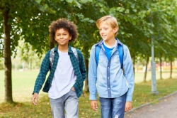
Carbon emissions from automobiles are one of the leading contributors to air pollution and the greenhouse effect that is causing climate change. In this hands-on activity students conduct a class survey to identify modes of transport to school and use this information with Google Maps to calculate distance and duration of various routes and travel methods. As pupils compare options such as walking or driving, they will develop their understanding of how active transportation choices can support a healthier planet and healthier people.
General Assessment
Recommendation of how and where to use it
This resource supports Grade 6-8 Science outcomes that are exploring climate change and concepts related to air quality and carbon emissions. The activity also examines sustainable transportation and how socioeconomic factors like vehicle availability may impact the travel choices of citizens in their community. Students use Geography and Mathematics skills to identify locations on maps and compare various distances and travel times.
Many schools are exploring greener approaches to student travel that encourage physical activity. After participating in this lesson, a class could develop an action project that highlights the multiple environmental and health benefits of walking or “rolling” to school. Green Communities Canada has an “Ideas Lab” that provides numerous resources that can be used to support student initiatives to reduce the environmental impact and improve the safety of school travel within their communities.
Relevant Curriculum Units
The following tool will allow you to explore the relevant curriculum matches for this resource. To start, select a province listed below.
- Step 1Select a province
- Alberta
- British Columbia
- Manitoba
- Step 2Select a grade level
- Grade 8
- Step 3Select a subject
- Physical Education & Health
- Step 4Relevant matches
- Physical Education and Health: Health Lifestyles Practices
- New Brunswick
- Newfoundland & Labrador
- Step 2Select a grade level
- Grade 5
- Step 3Select a subject
- Health Education
- Step 4Relevant matches
- Health: Active Living
- Grade 6
- Step 3Select a subject
- Health Education
- Step 4Relevant matches
- Health: Environmental Health
- Northwest Territories
- Nova Scotia
- Nunavut
- Ontario
- Step 2Select a grade level
- Grade 5
- Step 3Select a subject
- Physical Education & Health
- Step 4Relevant matches
- Health and Physical Education: Active Living
- Grade 7
- Step 3Select a subject
- Physical Education & Health
- Step 4Relevant matches
- Health and Physical Education: Active Living
- Science & Technology
- Step 4Relevant matches
- Earth and Space Systems: Heat in the Environment
- Grade 8
- Step 3Select a subject
- Physical Education & Health
- Step 4Relevant matches
- Health and Physical Education: Healthy Living
- Prince Edward Island
- Quebec
- Step 2Select a grade level
- Grade 5
- Step 3Select a subject
- Physical Education & Health
- Step 4Relevant matches
- Physical Education and Health: Adopt a Healthy, Active Lifestyle
- Grade 6
- Step 3Select a subject
- Physical Education & Health
- Step 4Relevant matches
- Physical Education and Health: Adopt a Healthy, Active Lifestyle
- Grade 7
- Step 3Select a subject
- Physical Education & Health
- Step 4Relevant matches
- Physical Education and Health: Adopts a healthy, active lifestyle
- Grade 8
- Step 3Select a subject
- Science & Technology
- Step 4Relevant matches
- The Earth and Space
- Yukon Territory
Themes Addressed
Air, Atmosphere & Climate (1)
- Climate Change
Land Use & Natural Resources (1)
- Transportation